
Built for serious hunters
Know your land.
Plan your hunt.
Parcel boundaries for 11 states. Free public land overlays. Offline topo. A daily Hunt Forecast for when game is moving. $40 a year, all of it.
Parcel boundaries for 11 states. Free public land overlays. Offline topo. A daily Hunt Forecast for when game is moving. $40 a year, all of it.
Free public land data, powerful tools, no monthly fee required.
Daily activity scores from solunar, weather, and pressure tell you when game is most likely to move. Plus today's peak windows and a 5-day outlook.
Property lines for 11 states: Minnesota, Utah, North Carolina, Montana, Wisconsin, California, Vermont, Arkansas, Colorado, Virginia, and Washington. Know where public ends and private begins.
Color-coded federal lands. BLM, USFS, National Parks, Fish & Wildlife, and state lands. Tap any parcel to identify the agency.
Hunting-specific categories. Tree stands, ground blinds, trail cams, kill sites, rubs, tracks, and more.
Real-time weather, wind direction, barometric pressure trends, moon phase, and golden hour, all in one card.
Download topographic maps for offline use. Hunt with no cell signal.
Record your hunts, scouting trips, and hikes. Review routes with distance, duration, and elevation gain.
GMU boundaries for 21 states. Free for everyone.
Permanent record of every hunt. Species, weapon, GMU, tag, weight, antler points, photos, and CSV export.
Share waypoints with your party, see members on the map, and message in real time.
Tap to measure distances and calculate area on the map. Plan food plots or estimate range.
Solo hunt? Set a check-in timer. If you don't tap in by the deadline, your contacts get a notification with your last location.
Public land maps and hunting tools are free, forever.
Free forever: public land overlays, GMUs for 21 states, weather, season dates, 10 waypoints, trail cams, safety check-in, PLSS and BLM Surface overlays, distance and area measurement, topographic base map.
Pro adds: parcel boundaries, unlimited waypoints with photos, GPS track recording, offline topo maps, harvest log with CSV export, hunt groups, and the Hunt Forecast tab.
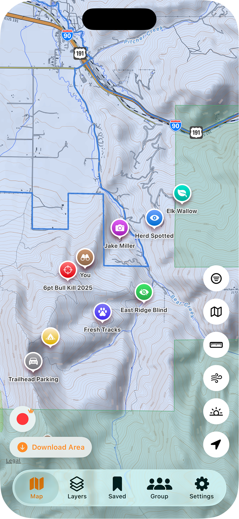
Mark every stand and sign.
Drop pins for treestands, trail cams, blood trails, and rubs. Public and private boundaries on the same screen. Topo terrain that loads offline.
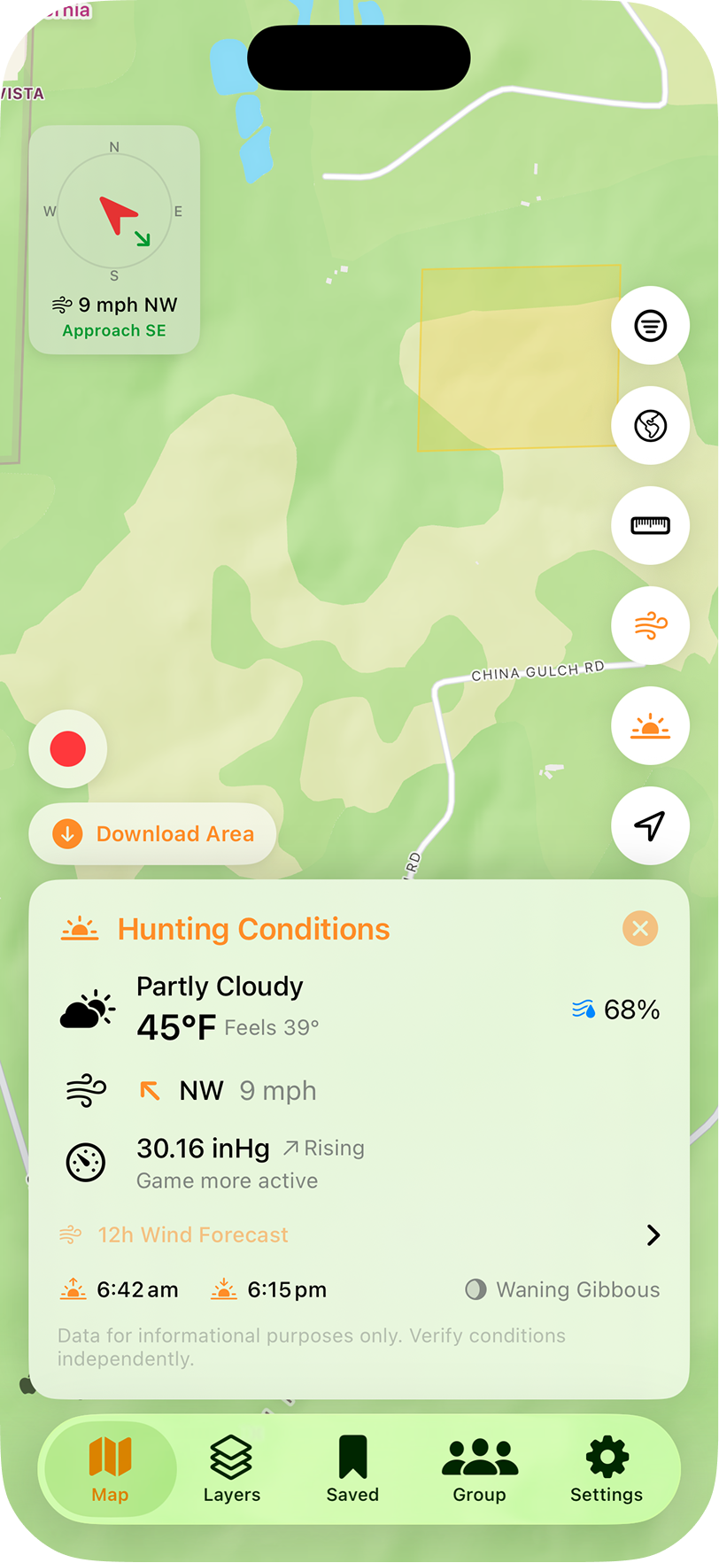
Approach from the right side.
Live wind compass tells you which way to come in. Pressure trend flags when game gets active. Sunrise, sunset, and moon phase one tap away.
Drop your email. We'll send a redemption code for one month of WikiHunt Pro on the house. Test the parcel boundaries, the offline topo, and the new Hunt Forecast before you commit to a full year.
One code per email. New subscribers only. We don't share your email.